![[BANNER Taking the Long View]](https://www.olt.org/cache/mod_bt_contentslider/d2c6c51978fdab3e17ccd8d8980720fe-8fe3e0f34d3083cba6fe73d62a783d7f_XL.jpg "[BANNER Taking the Long View]")
![[BANNER Couple at Top Ponds overlooking Valley 2001]](https://www.olt.org/cache/mod_bt_contentslider/8d6de82ae992633769df9f1d7f0ad949-fc34f61d23b74be53ee07d469bd32064_XL.jpg "[BANNER Couple at Top Ponds overlooking Valley 2001]")
![[BANNER Orient Mine Bats at Sunset]](https://www.olt.org/cache/mod_bt_contentslider/d6f440a7c762f882bb50c40477fe2eec-1c0ae2205709722b62e843abc0471a55_XL.jpg "[BANNER Orient Mine Bats at Sunset]")
![[BANNER Historic Everson Ranch]](https://www.olt.org/cache/mod_bt_contentslider/ce88ed9c48ba35c56bfd8f00fc280c34-fa55c8bad0e242eb7986dc1135b50adb_XL.jpg "[BANNER Historic Everson Ranch]")
![[BANNER Cozy Cabins]](https://www.olt.org/cache/mod_bt_contentslider/66c1ee6c9e4bd56c96ae5864236a4bcb-f7a0a54c92471ac4480e727e4ccf93df_XL.jpg "[BANNER Cozy Cabins]")
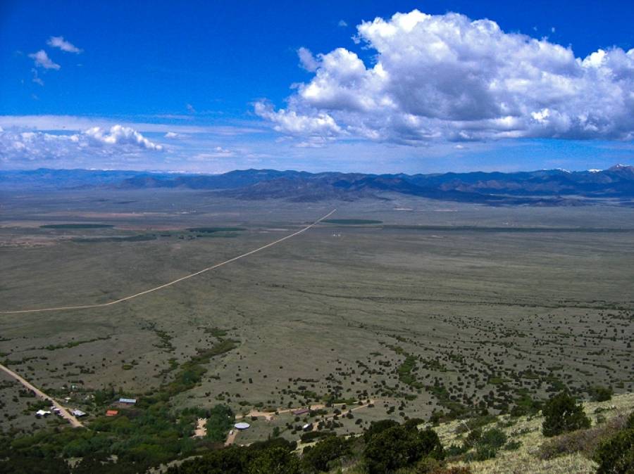
![[BANNER Awe Inspiring Skies]](https://www.olt.org/cache/mod_bt_contentslider/f4e33dc9bd6931aaf0515433fb346a97-f710044bf79a4b1f5d8b085e5e5d9711_XL.jpg "[BANNER Awe Inspiring Skies]")
![[BANNER Pure Waters]](https://www.olt.org/cache/mod_bt_contentslider/26a3834033f1336cb422cfa5efd9dacb-0b1ad7a7b79268a1f4558db78e092446_XL.jpg "[BANNER Pure Waters]")
OLT is located in Saguache County, the Northern-most county in the SLV. Environmental advocacy is just one of the ways the Orient Land Trust supports the northern San Luis Valley. Tourism and education bring interest, energy, and revenue back into the Valley.
The adjacent Rio Grande National Forest and Sangre de Cristo Wilderness Area provides abundant opportunities for hiking and mountain climbing.
USDA History and Culture Links
Saguache County
History and Geography
Saguache County's past and present are as diverse as the great expanse that it occupies. Its natural geography made it a crossroads and settlement area for Ute and other Natives Tribes, explorers, fur trappers, miners and settlers. Saguache County was officially founded in 1866. In the Ute language the word Saguache means, "water at the blue earth."
By the 1870's, gold, silver and other large mineral deposits were discovered in the Sangre de Cristo and San Juan Mountain ranges. By the 1930's, mining and railways moved out and farming and ranching moved in. Saguache County continues its agricultural heritage today despite the challenges of receiving less than 7 inches of precipitation per year. This 3,170 square mile high altitude desert is home to more than 75% public land, including national forests, wildlife areas and refuges, national park and wilderness areas.
The County is comprised of the Towns of Saguache, Moffat, Center, Crestone, Bonanza and the unincorporated areas of Sargents, La Garita and Villa Grove.
Demographics
In 2010, Saguache County's population numbered approximately 7000 people, with 53% living in the unincorporated areas. This represents full-time residents, however, many people are drawn to the County for seasonal activities increasing the population and the need for services. Population has grown about 11% since the year 2000. The largest minority groups include Hispanic/Latino, which represent about 34% of the population.
Economy
Statistically, Saguache County has been one of the most economically challenged counties in Colorado for decades. Economic growth is the concern Saguache County residents express most in planning processes. There is a clear need for activities that can ensure economic stability for residents while remaining consistent with the core community values of preserving open space and wildlife habitat.
The local economy is based on the traditional industries of ranching and farming that now struggle to provide a sustainable economic engine. The following industries rank in order of income importance to Saguache County: Agriculture (38.1%); Retirees (15.2%); Commuters (10.5%); Public Assistance (8.1%); Tourism (7%); Indirect (6.9%); Government (5.7%); and Manufacturing (2.8%).
In the year 2000, the median household price was $73,900 and median household income (MHI) was $25,495. While income increased 18.4%, the cost of housing increased nearly 90%. This means that home ownership is less affordable for full-time residents now than it was just a few years ago. This is reflected by the estimated per capita income of $18,284 as compared to $29,133 for the State of Colorado. Saguache County taxes, land-values and costs of goods and services remain some of the lowest you can find in this and surrounding states.
Education
Saguache County is home to three school districts: Center Consolidated D26JT, Mountain Valley Consolidated RE1 and Moffat Consolidated D2 that includes the Crestone Charter School. 580, 120 and 206 students were enrolled respectively during the 2010-2011 school year. Each district has experienced enrollment decline over the past 10 years and continue to face increasing challenges due to state education budget cuts. Center and Mountain Valley Schools have been identified by the Colorado Department of Education as districts in need of Priority Improvement Plans. It is not uncommon for Saguache County families to send children to larger school districts as far as Alamosa or Salida, both more than 50 miles away.
Other Resources
www.saguachecounty.net
www.choosesaguache.com
The adjacent Rio Grande National Forest and Sangre de Cristo Wilderness Area provides abundant opportunities for hiking and mountain climbing.
Attractions
Villa Grove, CO
Founded in 1882, the Town of Villa Grove sits towards the northeastern corner of the county on US 285, 15 miles south of Poncha Pass. It is an unincorporated town that has a resident population of approximately 30 people. In the past, it was a vital supply town for miners and ranchers. Today, it provides services for travelers and local residents alike. Villa Grove has a Post Office, Town Park, one year-round café/general store, motel, liquor store, pottery studio-gallery, and other businesses that serve the area's needs.
Bonanza, CO
Bonanza, incorporated in 1880, is a 'sister town' to Villa Grove and is located at the end of County Road LL56 in the Rio Grande National Forest, approximately 15 miles west of US 285. Mining was predominant in the entire region and ranching grew with the influx of families working in the area. During its heyday in the 1880's, the town had a population of 1500 and was renowned for its 36 saloons and seven dance halls. Remnants of mine structures can still be seen around the Town. Today, it has few full-time residents, and the Town Board has petitioned to become unincorporated. Bonanza serves primarily as a tourist attraction and National Forest access point.
Saguache, CO
The Town of Saguache is located at the junctions of US 285 and CO 114 in the northwestern part of the San Luis Valley and has a population of approximately 500 people. It is surrounded by ranching, agricultural and public lands and has a history steeped in sheep, cattle, grain, grass hay, and alfalfa production. It has been a gateway to the San Juan Mountains for centuries and a supply hub for travelers past and present.
Saguache is also the County seat. It houses local and county government buildings including the County's Social and Public Health services, State Registered Historic Courthouse with administrative offices, law enforcement offices and jail, road and bridge offices, pre-K through 12th grade school, Public Library, veteran's office and BLM and National Forest offices. The Town also has a large park with a community center building built in the 1930's with WPA funding.
The Town of Saguache is situated along a part of the Old Spanish Trail which follows CO northwest towards Cochetopa pass. There are many registered historic sites in and around the Town including the Saguache Flour Mill which is located approximately one mile outside of town and located within the Town are: the Saguache School and Jail buildings, which house the Saguache County Museum; St. Agnes Catholic Church, and Dunn's Block/Means & Ashley Mercantile Company. As part of an ongoing revitalization process, the downtown's Fourth Street business district was listed on Colorado Preservation, Inc.'s Most Endangered Places 2009 List.
Business that are located in and around Saguache include gas stations, grocery store/deli, liquor store, restaurants, hair salons, movie theatre, bookstore, lumber mill, lumber and hardware yard, day care center, abstract and title office, bank, newspaper, motels, several churches, organic farms, and auto mechanics.
Crestone, CO
The town of Crestone is located 12 miles east of CO 17 on County Road T along the base of the Sangre de Cristo Mountains at the eastern edge of the county. Crestone was incorporated in November of 1880. The current population is approximately 130 people. Mining and ranching fueled the early economy of the town and surrounding area. Presently, it is a destination for summer vacationers, hikers, climbers, retirees, and sacred-based tourism. The town has several businesses which also serve the near-by Baca Grande subdivision. These include the Crestone Eagle newspaper, a branch of Aventa Credit Union, several churches and spiritual centers, the Crestone Merchantile grocery store and hardware, Crestone Artisans Gallery, gift, and thrift stores, cafés and tea house, and liquor store. Built in 1880, the Crestone School, (now the community building), is a Nationally Registered Historic site. The area is also served by the Crestone-Baca Library, a fieldwork office of Colorado College, and the K – 12th grade Crestone Charter School.
Moffat, CO
Moffat was incorporated in the late 1890's to serve as a major hub for the Denver and Rio Grande narrow-gauge railroad line, which moved agricultural products and mining ore. It is located on CO 17 approximately 15 miles north of Hooper and 17 miles south of Villa Grove. In its peak, the population was in the thousands. From then, it dwindled to about 120 and has remained the same since the early 1920's. The Town has a Post Office, pre-K through 12th grade school and several businesses including a coffeehouse-gallery, health food cooperative, café'-bar, and health care clinic. The First Baptist Church of Moffat is a Nationally Registered Historic site. Moffat is surrounded by agricultural lands and has large areas of them within its town limits.
La Garita, CO
First settled by the Spanish in the early to mid 1800's, La Garita, meaning sentinel or lookout, is located approximately 6 miles west of US 285 on County Road G. It sits at the gateway to the La Garita Wilderness Area and the San Juan Range, and is surrounded by agricultural lands.
There is a local store which has a café and serves as an information center for local attractions such as the Penitente Canyon Recreation area, a premier rock climbing destination, La Garita Natural Arch and La Ventana (The Window) and several significant cultural sites, including two Nationally Registered Historic ones: the Capilla de San Juan Bautista Church and the Carnero Creek Pictographs.
Center, CO
Center is located on CO 112, approximately 13 miles west of CO 17 and 2 miles east of US 285. It is an incorporated town that has most of its boundaries in Saguache County and a portion in Rio Grande County located to the south. It has the largest population of the towns in Saguache County with approximately 2,389 residents. Large-scale agriculture is the main economic industry. Many farms, including some of the country's largest in organic production, surround the town and several agricultural processing plants are located here. Center has a commercial district with many shops and services, including a grocery store, gas stations, Town Hall and jail, Post Office, restaurants, hardware and feed stores, two banks, a credit union, and branches of the County's Public Health and Department of Social Services offices. Center has a pre-K through 12th grade school. There is a National Resource Conservation Services (NRCS) office which contains a Farm Service Agency and Conservation District office. A railroad spur called the "peavine" is located on the east side of Center and runs southwest to the Town of Monte Vista.
Sargents, CO
Settled in the late 1880's, Sargents is an unincorporated community located at the north-central boundary of the county and on US 50 at the west base of Monarch Pass. It served as a major refueling and maintenance stop for the Denver and Rio Grande Railroad until demand for the railroad declined. By the 1950's Sargents had all but disappeared. The old water tank and remains of coal chutes are still visible and the school house is on the Colorado Historic Register.
Today, there is a Post Office and local store with café, rental cabins, gasoline, towing, and car service. The community has approximately 25 full-time residents in an area with large ranches and 35-acre home sites.
Salida, CO
Note from Scott-The City of Salida is the county seat and most populous city of Chaffee County, Colorado, United States.[5] The population is around 5236 people.
Founded in 1880, Salida was originally a railroad town and was a significant link in the Denver and Rio Grande Western Railroad. After World War II the railroad began pulling back its operations in Salida. Many residents in the 1950s, 1960s, and 1970s worked either in local ranching operations or commuted north to Leadville to work at the Climax Molybdenum Company. Today, the most prominent business in Salida is tourism, consisting of skiing at Monarch ski area, whitewater rafting, kayaking and outfitting, particularly on the Arkansas River. Salida is home to the annual FIBArk kayak race, one of the oldest whitewater races in North America.
Salida’s charming downtown area, the largest historical downtown district in Colorado, is home to blocks of Victorian buildings with fantastic restaurants, inspiring galleries, tempting boutiques, outdoor sports stores, and an array of shops for kitchen, kids, books, knitters and quilters. It’s a great place to stock up or find a unique gift to take home.
Salida hosts an impressive calendar of performing arts and special events including great theater productions, a fantastic array of music at coffee shops, taverns, Salida High School’s John Held Auditorium, or the Salida Steamplant Performing Arts Center and Conference Center.
From Salida Chamber of Commerce Website and Wikipedia
Alamosa, CO
Note from Scott- The city of Alamosa is the county seat and the most populous city of Alamosa County, Colorado, United States. The population is 8,780. The city is the commercial center of the San Luis Valley in south-central Colorado.
Prior to 1868 the Capote (Kapota) band of Ute Indians lived in the valley.[11] The Utes made a treaty of peace with the United States in 1849 shortly after the Mexican War. Shortly thereafter settlers from New Mexico established several small settlements in what is now Colorado and in 1868 the Utes were removed to a reservation in western Colorado. They continued to play a role in Saguache in the northwestern corner of the valley from the Los Pinos Agency to the west of Saguache until they lost their expansive reservation as the result of the Meeker massacre in 1879.[12]
The area was administered as part of the Spanish, later Mexican, province of Nuevo Mexico until the area was ceded to the United States in 1848 after the Mexican-American war in the Treaty of Guadalupe Hidalgo.
Alamosa was established in May 1878 by the Denver and Rio Grande Railroad and quickly became an important rail center. The railroad had an extensive construction, repair and shipping facility in Alamosa for many years and headquartered its remaining narrow gauge service here with trackage reaching many points throughout southwest Colorado and northern New Mexico. Alamosa is now a notable tourist town with many nearby attractions, including the Great Sand Dunes National Park and Preserve and Colorado Gators Reptile Park. The town hosts "SummerFest on the Rio" which occurs the first weekend in June and the Early Iron car show over the Labor Day weekend. The city takes its name from the Spanish adjective Alamosa, meaning "of cottonwood", for the cottonwood forests which grow along the Rio Grande and throughout town
Agriculture in the San Luis Valley is generally concentrated around the Colorado towns of Alamosa, Monte Vista and Center. Principal crops include potatoes, head lettuce and barley. The barley grown here is the main supplier for Coors beer company. In 1982, quinoa was successfully grown for the first time outside of South America in the San Luis Valley of Colorado,[15] and commercial growth has occurred since 1987.[16] Less favored areas with a shorter growing season and less access to water rights tend to be devoted to alfalfa and grazing. Broad areas, especially in Saguache County, Colorado have a high water table or are even flooded part of the year. Uncultivated land is often covered with "chico", low brush such as rabbitbrush, greasewood and other woody species. Cropland is typically irrigated with large (1/4-mile radius) center-pivot irrigation systems, and a common feature of the Rio Grande Delta area where the Rio Grande enters the valley are large piles of potato-sized rocks screened from the soil.
The area supports a wide variety of wildlife. Sandhill cranes migrate through the valley every spring and fall. The Monte Vista Crane Festival takes place in March, centering on the wildlife refuge located six miles (10 km) south of town. Occasionally, a whooping crane can be spotted among the thousands of grey sandhills. The valley is a flyway for many migrating birds including avocets, bald eagles, goldfinches, and a plethora of hawk varieties.
Great Sand Dunes National Park
There's nothing else like it. The tallest dunes in North America are the centerpiece in a diverse landscape of grasslands, wetlands, conifer and aspen forests, alpine lakes, and tundra. Experience this diversity through hiking, sand sledding, splashing in Medano Creek, wildlife watching, and more!
Colorado Alligator Farm
What are gators doing in the valley? Well it started with the Rocky Mountain Tilapia fish
UFO Observatory
The clear night skies of the valley bring opportunities for sights astronomically known and unknown and mysterious. Consider a rendezvous at the UFO Watchtower outside of Hooper, CO.
Public Lands and Forests
OLT is surrounded by public lands composed of the Rio Grande National Forest and the San Luis Valley Bureau of Land Management. The Rio Grande National Forest is approximately 1.86 million acres in size and is located in the mountains surrounding the San Luis Valley. The SLV Bureau of Land Management is composed of almost 600,000 acres of land in the foothills and on the Valley floor.
Bureau of Land Management
US Forest Service
San Luis Valley Public Land Center
Hiking Trails
Food and Drink
Villa Grove- Villa Grove Trade 8am-4pm daily (www.villagrovetrade.com), The Steel Horse (opening May 4, 2013)
Saguache- The Oasis, 4th Street Diner and Bakery, Utopia Bar & Cafe in the Ute Theatre, Liquor Store (name?), Saguache Town Market grocery and gas, First Stop gas station
Crestone- Bliss Cafe, Farm Table, Desert Sage, Shambala Cafe, Elephant Cloud Organi, Secret Garden, Crestone Spririts Liqour Store and Crestone Mercantile grocery store
Moffat- S&S Station bar & grill, Mirage Trading Post Espresso and Gallery, Sangre de Cristo Trading Post grocery/supply/buffet lunch by donation
Ski Areas
Monarch Mountain (www.skimonarch.com), Wolf Creek Ski Resort (www.wolfcreekski.com), Toas Ski Valley (www.skitaos.org)
Camping
San Luis Valley Campground (Private)
North Crestone Campground (Public)
Lodging
The Inn at Villa Grove (Villa Grove Trade)
Hillside Motel, Saguache
Sagebrush Inn, Crestone
Facilities
RV dump station
San Luis Valley Campground
in Salida on Highway 50 by the Salida Museum